


ISRO's CARTOSAT-3 images show damages caused by earthquake in Myanmar
ISRO's CARTOSAT-3 images show damages caused by earthquake in Myanmar
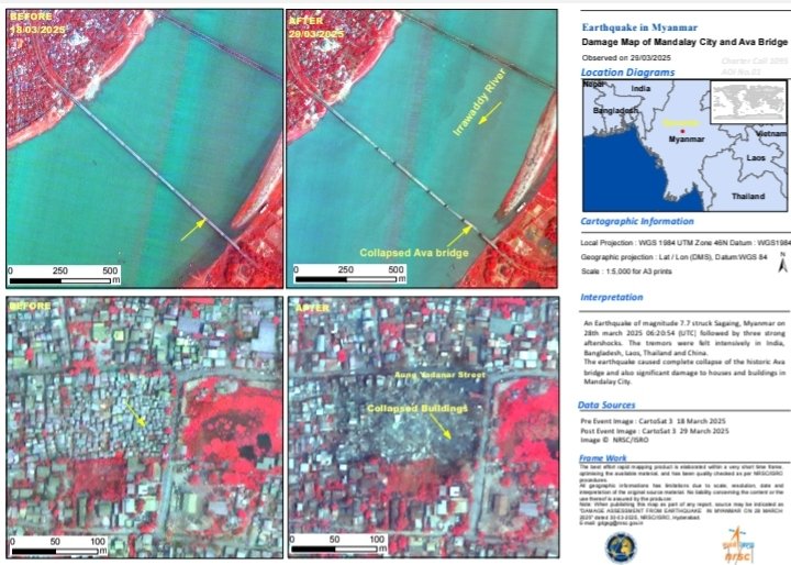
BENGALURU: (Apr 1) ISRO has released images captured by its earth imaging and mapping satellite, CARTOSAT-3 showcasing the damages caused by the earthquake in Myanmar on March 28.
The post-disaster Cartosat-3 imagery was acquired by ISRO on March 29 over the cities of Mandalay and Sagaing in Myanmar, it said.
Additionally, the pre-event Cartosat-3 data acquired on March 18 covering the same area was referred for change analysis and assessment of damage, the space agency said.